

Number of Trees selected: 0
Canopy Shading Ground: ---%
Canopy Shading Buildings: ---%
Canopy In Shade: ---%
Shading estimates are representative of selected buildings and trees
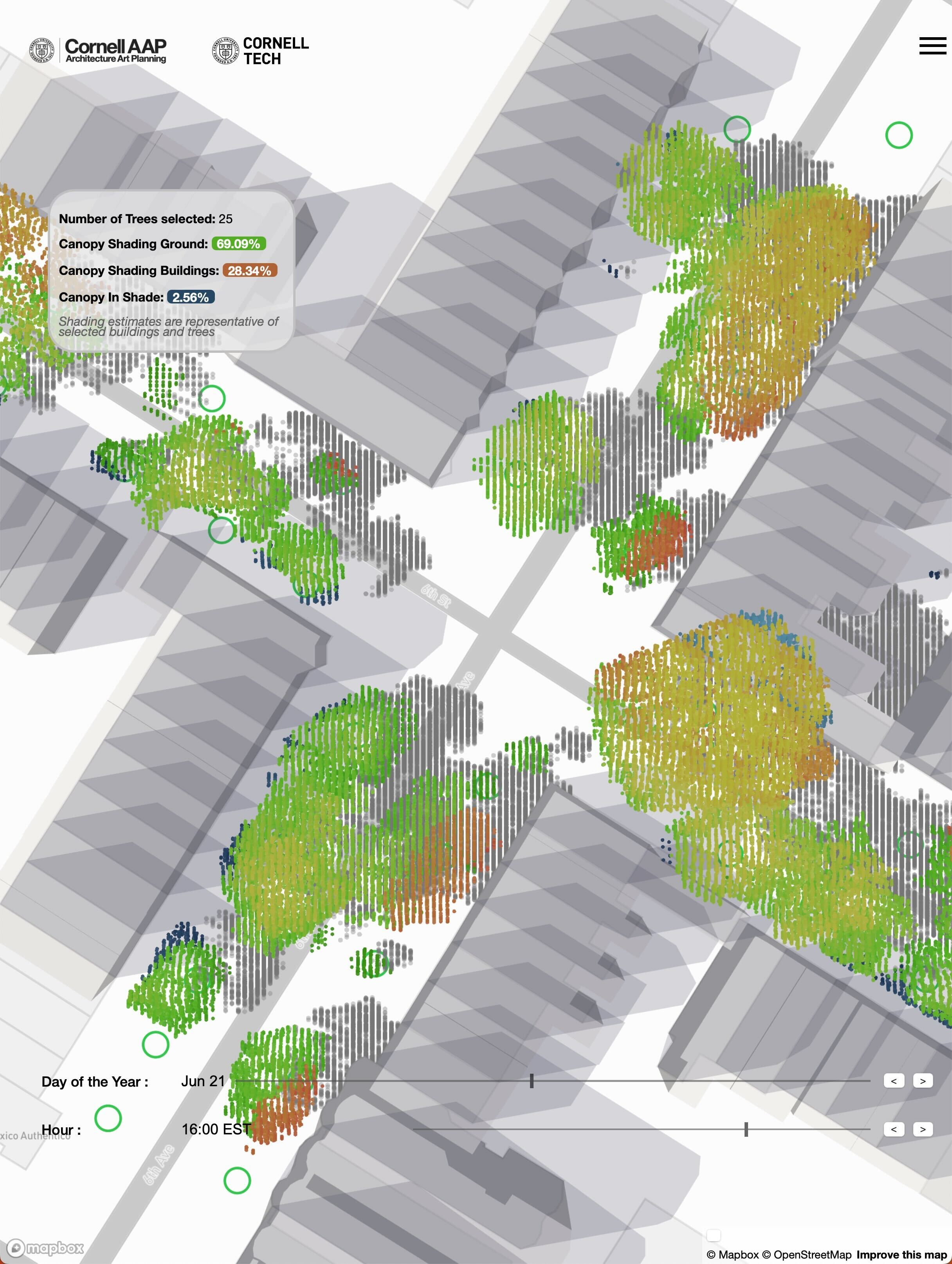
A digital twin of New York City’s Urban Canopy.
Tree Folio is a suite of tools to better understand and quantify the local impact of urban trees. Tree Folio extracts 3d models of every tree in NYC from publicly available, high-resolution LiDAR scans, simulates their local shading environments, and quantifies the amount and quality of shade they provide. The goal of the project is to develop strategies that are responsive to local needs and add up to have the maximum effect in mitigating climate effects for the future 'climate changed' city.
Left Click + Drag = Move Map
Right Click + Drag = Rotate and Tilt View
Left Click on Building Footprint = Load Building Model
Scroll To Zoom. Zoom in for individual tree locations.
Click on Green Circles = Load Tree Models
By the Design Across Scales Lab at Cornell AAP, supported and in collaboration with the Urban Tech Hub at the Jacobs Technion-Cornell Institute